
KRINAVI TRIP FIT
KRINAVI Trip Fit
85/100Trip Fit: 85/100 for a short, flexible walk between central-Seoul stops. The route is free and easy to shorten, but rain restrictions, rising water and a poorly chosen exit can change the plan.
- Time efficiency85/100
- Route fit85/100
- Planning flexibility85/100
- Weather resilience90/100
- Crowd control75/100
- Value for cost90/100
Before leaving, check the current crowd conditions and the operating notices linked below; the 75/100 crowd-control score is the lowest dimension.
Cheonggyecheon is best treated as one section of an existing day, not an 11-kilometre task. The public stream runs through central Seoul and can make a useful 30–90-minute walk between nearby districts. Choose a start and exit that match the next stop instead of following the entire waterway.
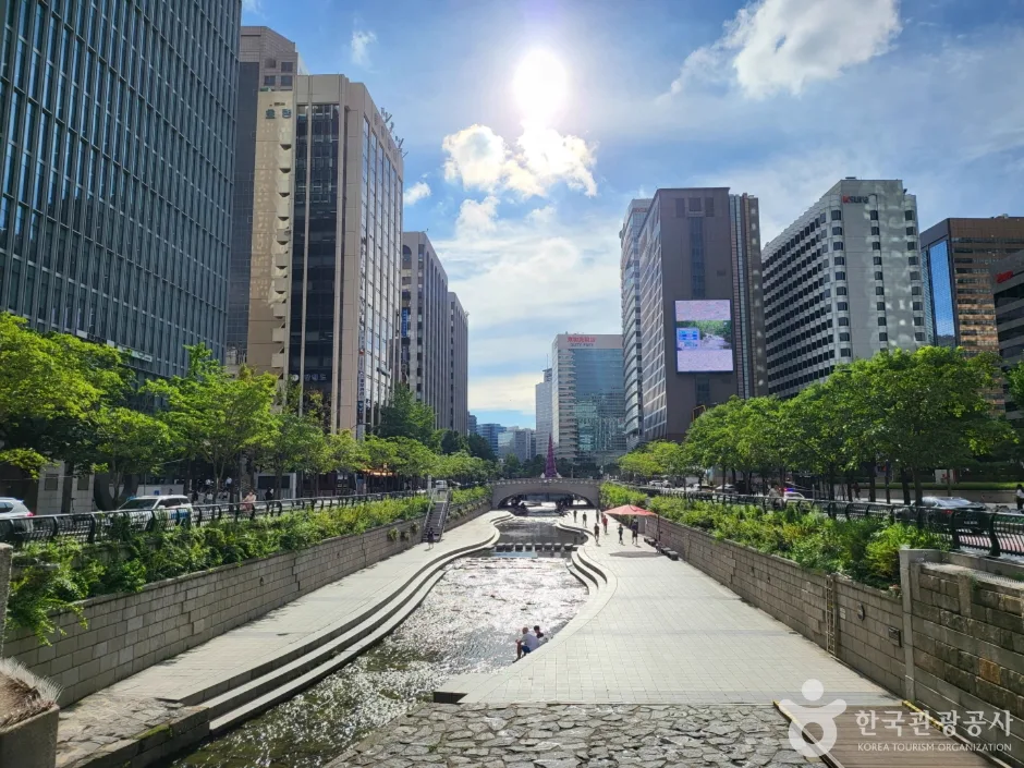
- SECTION — Pick Cheonggye Plaza, central Jongno or the stretch toward Gwangjang Market and Dongdaemun.
- LIGHT — Daytime makes the path and exits easier to read; at night, take extra care around stairs and meeting points.
- EXIT — Save the next bridge, station and group meeting point before going down, especially with children or older companions.
- A short pause, two bridges or a post-dinner walk can be enough; there is no need to cover every section.
Cheonggyecheon is not one point: choose the section first
Visit Seoul describes an approximately 11-kilometre route from Cheonggye Plaza passing under 22 bridges. These figures describe the corridor, not a recommended one-day target. A map pin for the stream may lead to a section that does not fit your day, so choose the district and exit before travelling there.
Start near City Hall, Gwanghwamun or Myeongdong if that is already on the day’s route. Continue toward Gwangjang Market only when the return and next stop fit; the linked four-day plan shows how to place the walk inside a Seoul day. Related: four-day Seoul itinerary
Cheonggye Plaza is clear, but not always the best fit
Cheonggye Plaza gives first-time visitors a recognisable starting point, with a waterfall, fountains, paths and information about the bridges. It can work for a short visit, though office lunch breaks, weekends and programmed events may make the plaza busier than its quieter photos suggest.
When the itinerary already passes City Hall, Jongno or Dongdaemun, decide on the day whether to walk a couple of bridges or continue east. The five-day plan can help place the stream without giving it a whole day. Related: five-day Seoul itinerary
Day, dusk or night: which version should you choose?
In daylight, the water, stonework and exits are easier to see. Dusk offers some remaining light; a night walk can fit after dinner, but steps and meeting points need more attention and popular sections may be busy.
Festival lighting, outdoor reading areas and fountains operate on specific dates or schedules. Check the current event notice before choosing a night walk; the linked Seoul night guide compares other evening options. Related: Seoul night-experience decision
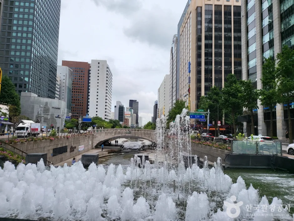
Open 24 hours does not mean accessible in every weather condition
Visit Seoul lists the promenade as open around the clock while warning that rain can restrict access. Seoul Metropolitan Government explains the risk: water may rise quickly and cover the path. Leave by the nearest exit if an announcement sounds or barriers are in place; do not shelter below a bridge.
Rain can close the lower path, so save an indoor alternative before you leave. The linked rainy-day guide helps keep the replacement close to your current district. Related: Seoul rainy-day plan
It can feel cooler in summer, but it is not air conditioning
The lower path offers shade in places, but remains outdoors. In summer heat, shorten the walk, bring water and keep an exit toward an indoor stop. Stairs and changes between street level and the stream add effort, so do not extend the route just to reach a named bridge.
On a cold day or when the group needs a break, compare the walk back to the hotel with a shorter route. The linked hotel-base guide helps judge whether returning for a rest is practical. Related: Seoul hotel base for a midday rest
Many nearby subway stations do not make every entrance equally useful
The listed stations span several districts along the corridor. That range is useful only when paired with the right entrance and exit; the closest station to your starting point may not be close to where you want to finish.
Choose the entry and exit station together, then save each location on your phone. A transport card handles payment, but it does not identify the correct waterside staircase. Related: Korea transport card
Accessible facilities exist, but 11 kilometres are not one flat path
Visit Seoul lists accessible routes, lifts and restrooms, but access varies by entrance and section. Confirm the lift or ramp at both ends before setting out, then choose a distance that works for a wheelchair, stroller or anyone who needs to limit stairs.
For children, treat the stream as a short walk and observation stop; swimming, bathing, bikes and roller skates are prohibited. The linked family itinerary can keep the outing short, while the parents’ stay guide helps count the full hotel-to-stream return. Related: family four-day Seoul itinerary · where to stay in Seoul with parents
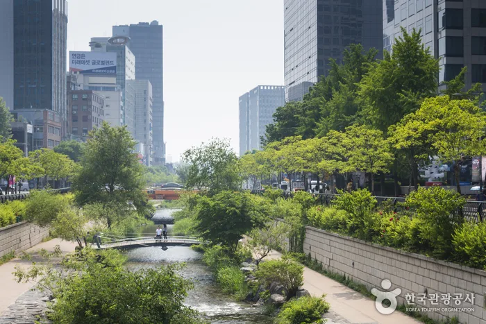
Where should the stream lead next? Choose one direction
The western section links naturally with City Hall, Gwanghwamun and Myeongdong; central Jongno connects with restaurants and shops; farther east can lead toward Gwangjang Market and Dongdaemun. Avoid walking east and then retracing the route for a timed booking in the west.
Use the stream as a link after lunch, between shops or on the way back from dinner. If it forces a cross-city detour or leaves no time to return, it can be omitted without changing the rest of the Seoul day.
Seven checks before going down to the stream
- Choose the plaza for a clear start, central Jongno for nearby streets, or an eastern section when Gwangjang Market or Dongdaemun is next.
- Check the day’s lighting and event schedule instead of expecting festival installations on an ordinary evening.
- Set the next bridge or station as your exit before descending.
- Shorten or postpone the walk when heat, cold, rain or crowding makes the chosen section uncomfortable.
- Walk for 30–90 minutes when the route connects two central-Seoul stops already in your plan.
- For a shorter visit, stay near the plaza or walk a few bridges; leave if weather or access notices change.
- Skip the stream when reaching it requires a cross-city detour or the return would put a timed booking at risk.
Information checked 25 October 2026: the approximate length, 22 bridges, opening information, nearby stations, rain restrictions and public-use rules were checked against Seoul Metropolitan Government, Visit Seoul and Korea Tourism Organization material. Water levels, closures, lifts, fountains, lighting and events can change on the day; follow on-site instructions.
Official visitor and municipal information: Related: Visit Seoul: Cheonggyecheon walking route · Seoul Metropolitan Government: Cheonggyecheon · Korea Tourism Organization: Cheonggyecheon Stream
KriNavi decision card
Best use of this page: Plan a short Cheonggyecheon walk between two central-Seoul stops.
Choose the section that fits the places already on your route, then save the exit before descending. A 30–90-minute walk can connect City Hall, Jongno, Gwangjang Market or Dongdaemun; the full corridor needs a separate plan.
Sources checked in this page: Visit Seoul: Cheonggyecheon walking route · Seoul Metropolitan Government: Cheonggyecheon · Korea Tourism Organization: Cheonggyecheon Stream